

Customizable ALOS-4 Data.
Transparent Pricing.
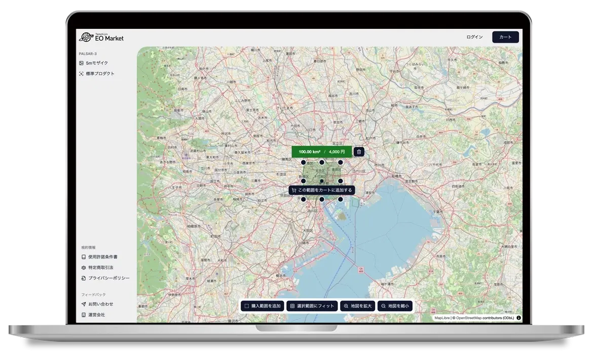
Intuitive Buying Experience
Online platform for purchasing satellite data 
※Available via PC browser


About
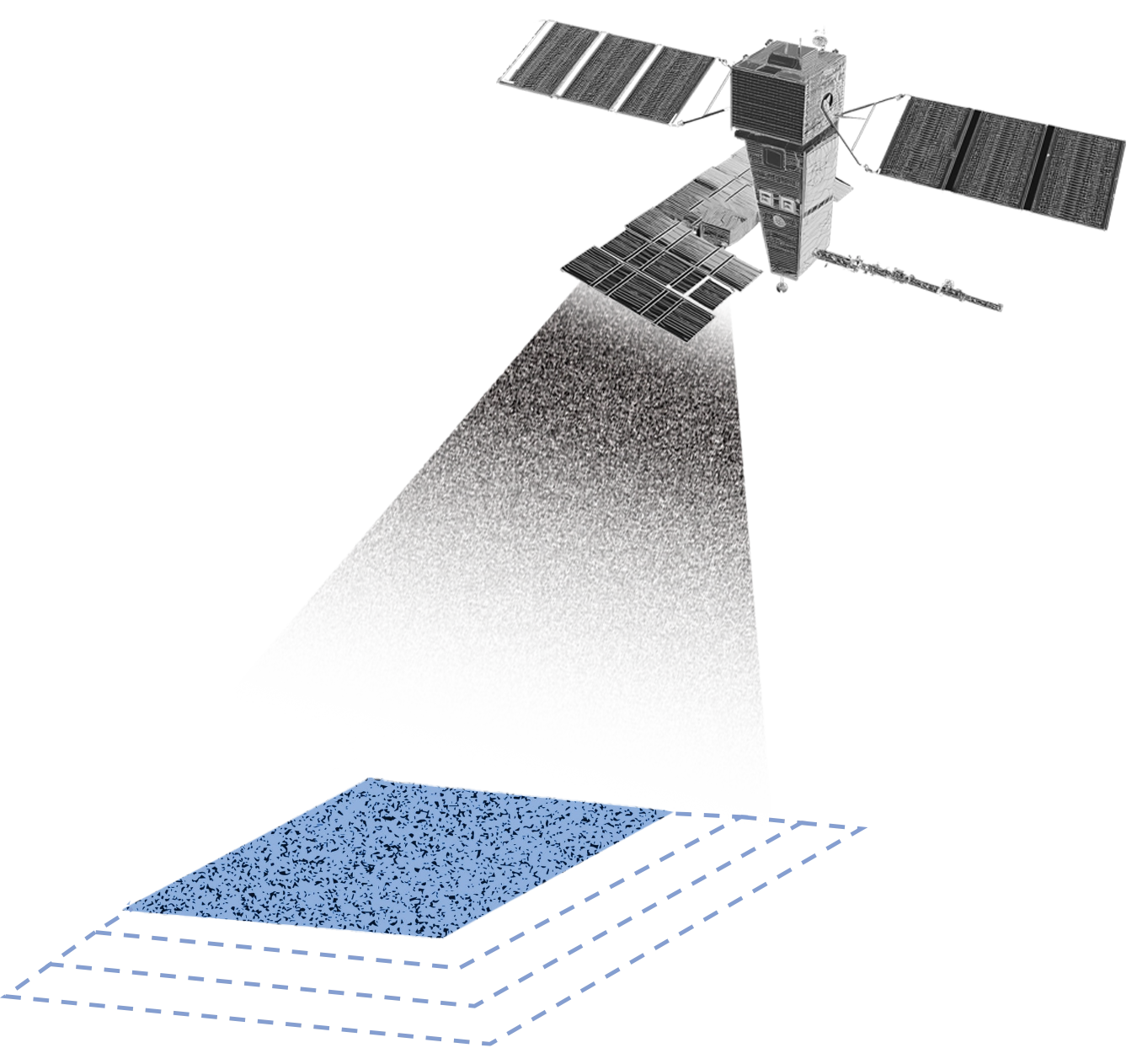
Tenchijin EO Market is an online platform where you can easily purchase ALOS-4 satellite data at low cost.
Tenchijin EO Market has created a new sales method to make satellite data sales easier and more accessible to a wider audience. In addition to the traditional JAXA data, a new dataset has been added that allows users to purchase data from any location. What was previously sold individually as a single scene is now available at the affordable price of JPY 4,000 (tax included) for 100km². Furthermore, the sales process, which previously required many steps and specialized knowledge, has been simplified by designing a sales site with an easy-to-understand UI that makes it easy for anyone to purchase. By purchasing only the parts you want and in the minimum amount, you can significantly reduce your budget. We have created a satellite data sales site that makes it easy for casual users who previously just wanted to use the data for personal research or were interested in it.
Service
We offer two types of plans for ALOS-4 satellite data depending on your needs.

Plan
"Tenchijin EO Market" offers two plans that allow you to conveniently purchase satellite data according to your needs.
PALSAR-3 5m Mosaic
(Limited to certain regions in Japan)
Until now, satellite data sales have had problems such as complicated procedures and being difficult to use without expertise, but Tenchijin has solved these problems by providing easy, convenient, and fast original satellite data.
1
Easy-to-use UI and simple data acquisition process
Tenchijin EO Market offers a simple acquisition process and a friendly user interface that anyone can understand! Data is provided with an intuitive UI that can be used by anyone, even those who are not researchers or research institutions. It can be used without specialized knowledge.
2
Buy only the size you need
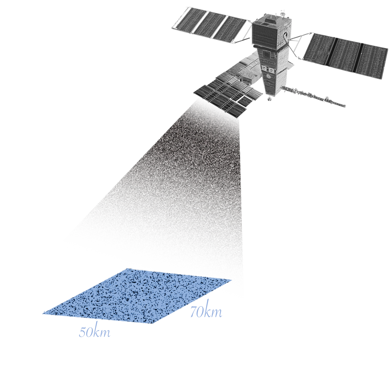
Until now...
You had to purchase a fixed number of scenes, such as 50 x 70 km, and you couldn't purchase in any unit you wanted.
EO Market
You can customize your size in 10km² increments and purchase as much as you need.
Previously, satellite data was purchased in units of one scene (50 x 70 km), but with Tenchijin EO Market, you can purchase data in any size you like, such as 80 km or 120 km.
3
Transparent pricing

PALSAR-3 5m Mosaic
JPY 4,000 (tax included) per 100km²
We have set the price at JPY 4,000 (tax included) per 100km² so that many people can easily purchase it.
4
Rapid data provision
Previous sales sites had irregular data delivery times, but PALSAR-3 5m Mosaic has a rapid delivery system in place. You can quickly obtain the data you need online. (*The delivery time for PALSAR-3 Standard Product does not apply.)
Main specifications
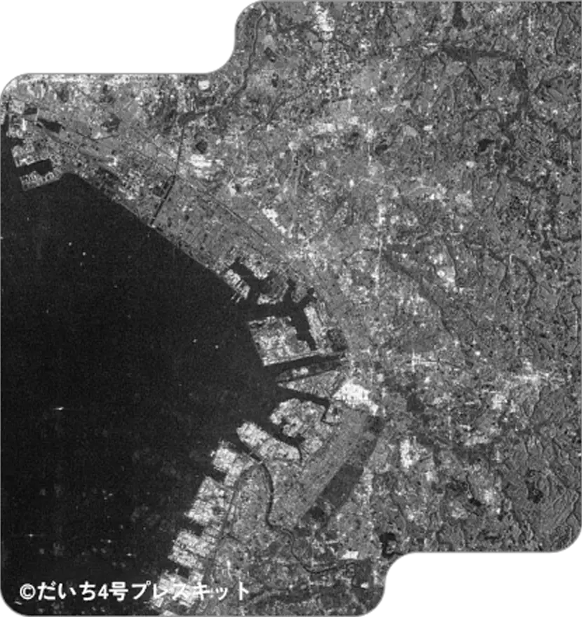
・ALOS-4/PALSAR-3 (SM1 mode, HH+HV polarization)
・Providing 5m resolution ortho-corrected data based on L2.1 ortho data
・Join multiple scenes together and specify and acquire any location from a wide area.
Please check the following file for details.
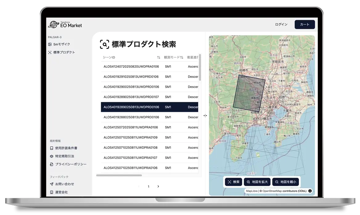
How to purchase
Credit card only.

Select Data
Search for desired satellite data on Tenchijin EO Market.

Payment
Enter the required information on the purchase page and complete the payment.

Download today
After payment, the data will be available on your My Page for download.
PALSAR-3 Standard Product
For those familiar with satellite data analysis, we provide PALSAR-3 data provided by JAXA as is.
1
Easy search on the map
Access Tenchijin EO Market, search and select the data you want to obtain, and provide it to the user.
2
PALSAR-3 data provided by JAXA as is
While PALSAR-3 5m Mosaic is limited to certain regions in Japan, this app can acquire data from all over the world. It also acquires SLC data that can be used for interferometric SAR.
Please check the following file for details on the data available for purchase.
3
Fair pricing
PALSAR-3 Standard Product
JPY 39,800 (tax included) per scene
We have set the price so that many people can easily purchase it.
How to purchase
Credit card only.
Select Data
On Tenchijin EO Market, enter the information for the data you want to obtain.
Payment
Enter the required information on the purchase page and complete the payment.

Data Preparation
We will collect the data and provide it to you within a few days to about two weeks.

Delivery
A notice will be emailed to you when the data is ready. Download will be available on "My Page".
Purchase ALOS-4 satellite data now in the size you want, at a reasonable price, and with a simple process!
Online platform for purchasing satellite data
※Available via PC browser
Use Cases
ALOS Series/L-band SAR Application Examples
©JAXA
Disaster Prevention
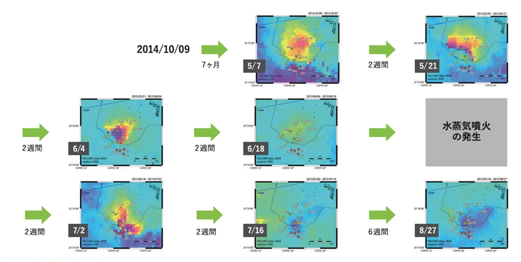
Grasping displacement just before an eruption and utilizing it for advance safety measures
In June 2015, the first ever eruption occurred at Mount Hakone in Kanagawa Prefecture. Interferometric analysis based on ALOS-2 images taken before and after the eruption confirmed that an uplift had occurred in an area of approximately 200m around Owakudani, the center of which coincided with the location of the hot spring supply facility where abnormal fumarolic activity occurred in May. As a result, it was determined that the abnormal fumarolic activity was related to surface displacement, and a complete ban on entry to Owakudani was decided. As satellite observations were able to capture displacement at the site of the eruption just before it occurred, advance safety measures were put in place.
(Source: ALOS-4 SOLUTION BOOK (JAXA) )
©JAXA
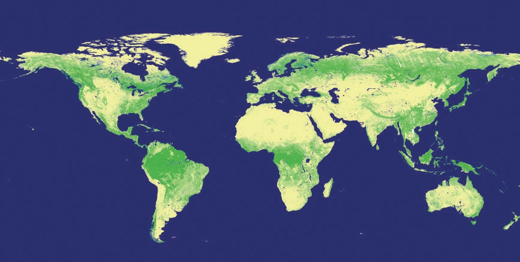
Forest
Understanding deforestation and carbon stocks from satellites
The L-band SAR, which is also installed on ALOS-4, is less affected by clouds and has the ability to penetrate vegetation. This makes it effective for observing tropical rainforests, which are often covered by clouds. Using the HV polarization of L-band SAR, it is possible to determine the presence or absence of trees, allowing for information on forest distribution and its changes. Furthermore, because the HV polarization contains quantitative information on forests, it is possible to estimate the amount of carbon stored in forests. For this reason, it is expected that ALOS-4 will also be used to monitor deforestation around the world and to make policy decisions to prevent global warming.
(Source: ALOS-4 SOLUTION BOOK (JAXA) )

©JAXA
Infrastructure
Improving road maintenance and management efficiency
Currently, road maintenance is mainly carried out by patrols by vehicle or on foot and regular inspections of each structure, but more efficient maintenance is an issue in terms of costs (manpower, time, and expenses). Therefore, the Road Structures Research Department of the National Institute for Land and Infrastructure Management and the University of Tokyo used ALOS-2 to verify the applicability of satellite SAR image data by comparing it with data obtained by general-purpose measurement methods in identifying potential risks to roads. The results suggested its effectiveness as a screening tool for detecting deformation over a wide area, covering the amount of road surface subsidence in a series of sections.
(Source: ALOS-4 SOLUTION BOOK (JAXA) )
©JAXA
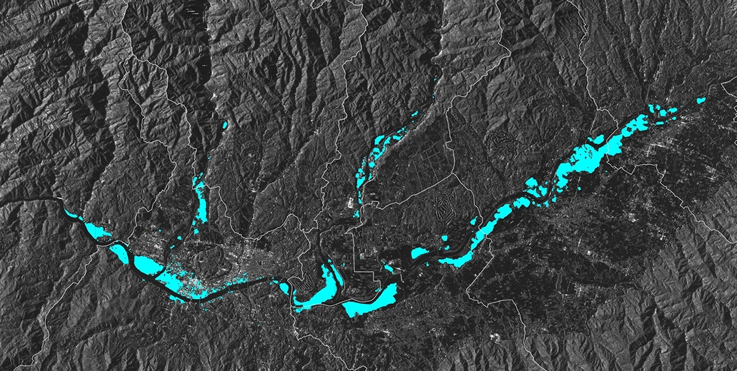
River Flooding
Extracting flooded areas from emergency observations
Heavy rains that began on July 3, 2020, caused by the intensification of the rainy season front and the passage of a small low pressure system, resulted in river flooding and landslides, mainly in Kumamoto Prefecture. Based on a request from the Ministry of Land, Infrastructure, Transport and Tourism, emergency observations were conducted using the L-band synthetic aperture radar (PALSAR-2) onboard ALOS-2 at approximately 1:13 PM on July 4 and 12:04 AM on July 5 (both Japan time). Flooded areas estimated from the observation data were provided to disaster prevention organizations, including the Ministry of Land, Infrastructure, Transport and Tourism.
©JAXA
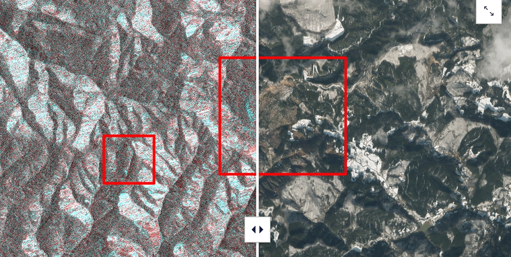
Earthquake
Emergency observation for the Noto Peninsula earthquake
In response to a request from domestic disaster prevention organizations, JAXA conducted emergency observations using the Synthetic Aperture Radar (PALSAR-2) onboard ALOS-2 in response to the magnitude 7.6 earthquake that occurred on the Noto Peninsula at approximately 4:10 p.m. on January 1, 2024. Two satellite images taken before and after the earthquake were colored, and areas where changes had occurred were extracted by overlaying them. Areas where landslides were suspected were discovered, and the data was provided to disaster prevention organizations and used for helicopter surveys, etc.
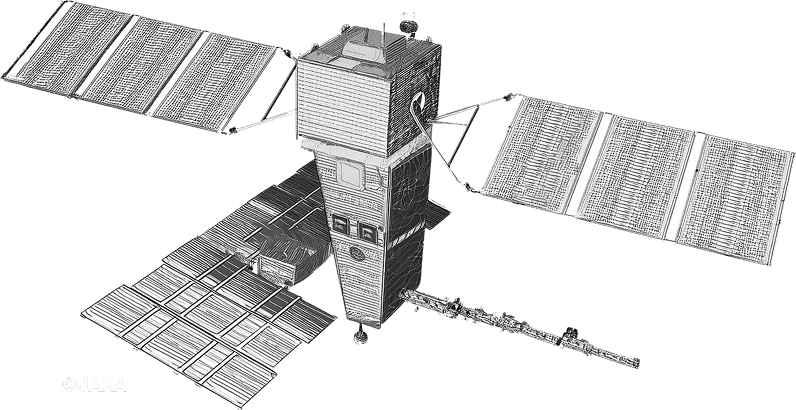
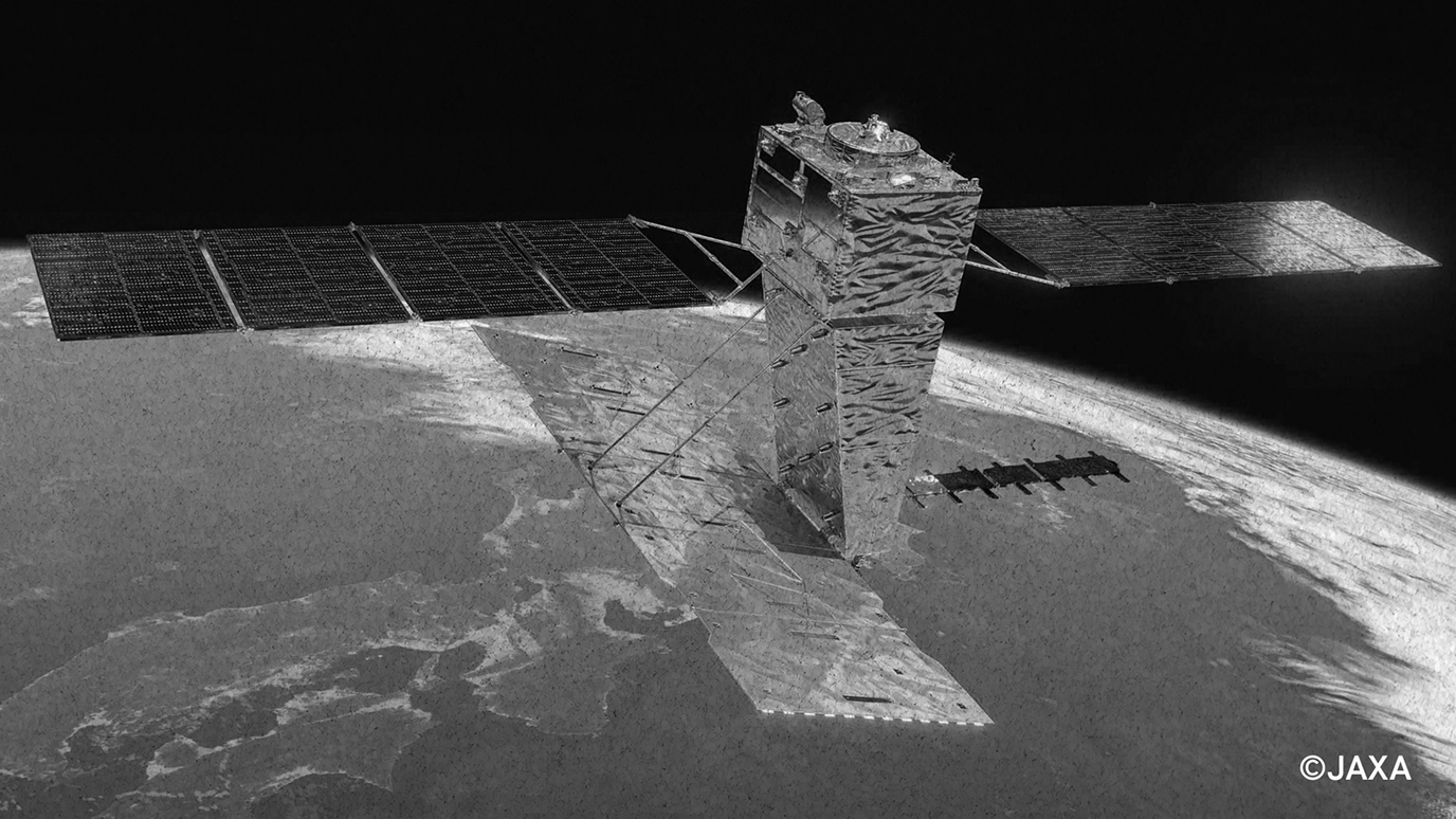
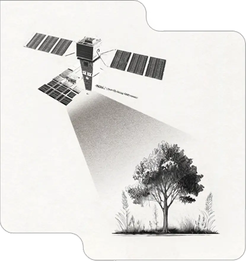
ALOS-4
ALOS-4 is an artificial satellite that observes the Earth using an L-band synthetic aperture radar.
About ALOS-4
"ALOS-4 (DAICHI-4)" is a JAXA satellite launched on July 1, 2024, from the Tanegashima Space Center aboard the H3 rocket No. 3. It observes the Earth using an L-band synthetic aperture radar (SAR) that enables wide-area observation while maintaining high resolution.
Observation using Synthetic Aperture Radar (SAR)
Synthetic aperture radar (SAR) sends radio waves from a satellite antenna and understands the state of the Earth's surface from the information that is returned. In addition, because it uses radio waves that it transmits itself, it does not require sunlight and can make observations at night. The radio waves it uses can also pass through clouds and rain, so it can make observations even in bad weather.
Stable detection of ground movement
ALOS-4 uses an L-band sensor, which has been continuously developed in Japan, and has high penetration and interference through vegetation compared to the X-band and C-band used by many other SAR satellites. This allows it to reliably capture ground movements even in Japan, which has a large forested area.
(Source:Satenavi(JAXA))
Main specifications of observation mode
| Observation Mode | Spotlight Mode | High resolution 3m mode | High resolution 6m mode | High resolution 10m mode | Wide-area observation mode | |||||||
|---|---|---|---|---|---|---|---|---|---|---|---|---|
| Swath Width200km | Swath Width100km | Full polarimetry observation | Swath Width200km | Swath Width100km | Full polarimetry observation | Swath Width200km | Swath Width100km | Full polarimetry observation | ||||
| Resolution(m)※1 | Range | 3 | 3 | 3 | 3 | 6 | 6 | 6 | 10 | 10 | 10 | 25 |
| Azimuth | 1 | 3 | 3 | 3 | 6 | 6 | 6 | 10 | 10 | 10 | 25 | |
| Observation swath(km)※2 | 35 | 200 | 100 | 100 | 200 | 100 | 100 | 205 | 100 | 100 | 700 | |
| Number of polarizations※3 | 1,2 | 1,2 | 1,2 | 4 | 1,2 | 1,2 | 4 | 1,2 | 1,2 | 4 | 1,2 | |
※1: Defined on the equatorial ground range plane, with an incidence angle of 37 degrees. ※2: Defined on the equatorial ground range plane. ※3: Polarization base is a straight line (horizontal/vertical).
Scene size
| Observation Mode | Spotlight Mode | High resolution 3m mode | High resolution 6m mode | High resolution 10m mode | Wide-area observation mode | ||||||
|---|---|---|---|---|---|---|---|---|---|---|---|
| Swath Width200km | Swath Width100km | Full polarimetry observation | Swath Width200km | Swath Width100km | Full polarimetry observation | Swath Width200km | Swath Width100km | Full polarimetry observation | |||
| Scene Width(km)※1 | 35 | 55 | 55 | 55 | 55 | 55 | 55 | 70 | 70 | 70 | 700 |
| Scene Length(km)※2 | 35 | 70 | 70 | 70 | 70 | 70 | 70 | 70 | 70 | 70 | 355 |
※1: Distance in range direction ※2: Distance in azimuth direction
Defining the Processing Level
| Processing Level | Product Contents |
|---|---|
| L1.1 | Complex image (including amplitude and phase information) projected onto a slant range after range compression and one-look azimuth compression. |
| L1.2 | Signal data that has undergone various correction processes and has been converted to a data equivalent to that observed with a single beam. Users must visualize the data themselves. |
| L1.5 | Range-compressed and multi-look azimuth-compressed amplitude image projected onto ground range (georeferenced or geocoded). |
| L2.1 | Ground range amplitude image orthorectified to L1.5. |
Purchase ALOS-4 satellite data now in the size you want, at a reasonable price, and with a simple process!
Online platform for purchasing satellite data
※Available via PC browser